Nor'easter's expected impact on NYC intensifies as storm nears
Published in News & Features
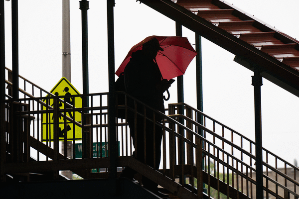
NEW YORK — New Yorkers are battening down for a brutal weekend, filled with heavy rainfall and intense winds, as a powerful early-season nor’easter threatens to wallop much of the East Coast.
The storm’s track was initially unclear at the start of the week, as was its intensity and its potential impacts. Now, as it barrels ever closer, meteorologist warn that the storm is likely to be even worse than early forecast models suggested.
By late Thursday morning it seemed slated to skirt past New York City, curving slightly toward New England, but it started to shift by the afternoon, according to the National Weather Service. That means the winds will be stronger, rainfall totals will likely be more, and the risk of flooding much higher than initially anticipated.
“The storm’s expected path has shifted closer to our city, bringing heavier rain and stronger winds,” Mayor Zohran Mamdani said Friday.
“If you’re traveling this weekend, give yourself extra time. Check your train, ferry, or flight before you leave, and avoid low-lying coastal roads around high tide,” he added. “If you live in a basement apartment, know your way out and be prepared to move to a higher floor if conditions become dangerous.”
The city’s Department of Emergency Management took it a step further, urging against all travel when possible.
Friday kicked off mostly mild, with temperatures likely to peak in the mid-60s — but conditions were expected to rapidly deteriorate as the nor’easter strengthens and pushes north up the coast. According to the National Weather Service, it will remain mostly cloudy throughout the day before rain showers and fierce winds hit the area Friday evening and continue through Saturday morning. From there, it will only intensify, with bursts of heavy rainfall expected throughout Saturday afternoon.
The storm will likely to be its most intense Saturday evening into Sunday afternoon, during which time dangerous winds and intense downpours could disrupt travel across the region. Widespread accumulation is expected to exceed 2 inches, with localized rainfall totals forecast to reach up to 5 inches.
A wind advisory has been issued through Sunday morning. Sustained winds will reach 25 to 35 mph with gusts up to 55 mph, capable of downing tree limbs and causing power outages. Officials additionally issued a travel advisory from Friday at 2 p.m. through the morning of Sunday and a coastal flood warning was also in effect.
“New Yorkers should prepare for a prolonged period of strong winds along with rain and coastal flooding through much of the weekend,” said NYCEM Commissioner Christina Farrell. “We are particularly watching the Friday evening and Saturday morning high tides, especially in the Rockaways, around Jamaica Bay and along the Staten Island and Brooklyn shorelines.”
She added: “Move your car away from streets that regularly flood, secure anything outside that could become airborne and never drive or walk through floodwater. We are working closely with the NWS and agencies across the city and will keep New Yorkers updated as the forecast changes.”
On Sunday, the nor’easter will begin to weaken, though New Yorkers could still experience some rainfall throughout the day into Monday, with sunshine set to return to the city on Tuesday and Wednesday.
_____
©2026 New York Daily News. Visit nydailynews.com. Distributed by Tribune Content Agency, LLC.






Comments